(970) 631-4190

Software

Get the Most
Out of Your Data

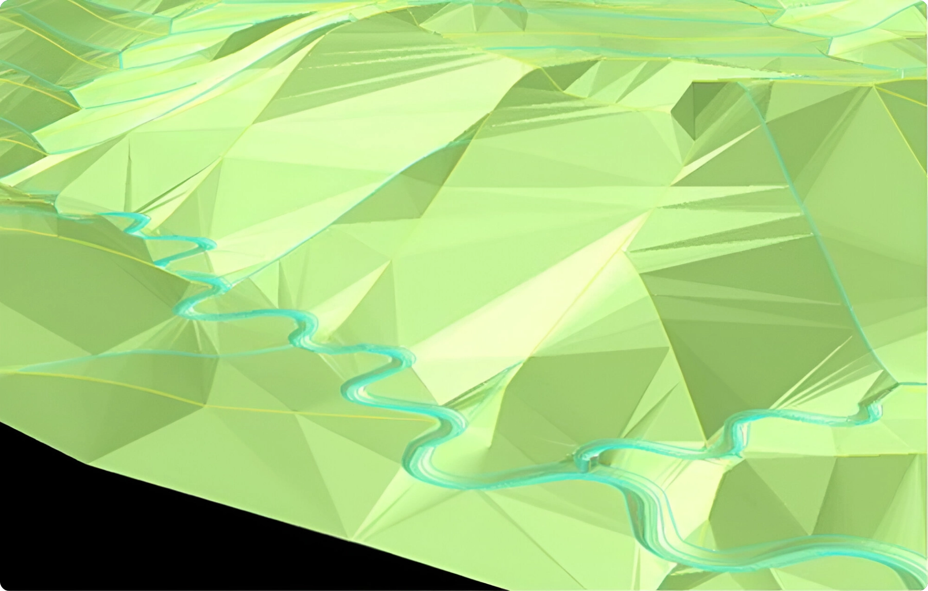
The fluvial geomorphic approach to designing landforms that are stable against erosion and promote sustainable land development, requires that essential landform characteristics are incorporated into the landform and that the characteristics are correctly inter-related for proper function. The GeoFluv approach to landform design uses measurements of these essential reference area landform characteristics of upland areas and ephemeral, intermittent, and perennial stream channels as input values and seamlessly integrates them in three dimensions to design a functioning landform.   The GeoFluv training and certification program teaches the user how to identify and measure the necessary  input values.

Geofluv & Natural Regrade

Natural Regrade software screen showing 3D rendering of the GeoFluv design. Note the complex slopes defined by the blue swale and yellow sub-watershed ridge design lines on the valley walls and the detailed channel plan-view and cross-sectional geometry characteristics, as well as the channel confluences that are designed automatically on grade.

The incorporation of the GeoFluv approach into the Natural Regrade computer software greatly simplifies the calculations needed to integrate these input values into a cohesive landform design. As with any computer program, the quality of the input information determines the quality of the output result and that is one of the reasons that GeoFluv training is so important.

Natural Regrade software screen showing 3D rendering of the GeoFluv design. Note the complex slopes defined by the blue swale and yellow sub-watershed ridge design lines on the valley walls and the detailed channel plan-view and cross-sectional geometry characteristics, as well as the channel confluences that are designed automatically on grade.

The incorporation of the GeoFluv approach into the Natural Regrade computer software greatly simplifies the calculations needed to integrate these input values into a cohesive landform design. As with any computer program, the quality of the input information determines the quality of the output result and that is one of the reasons that GeoFluv training is so important.  The final design can be rendered for construction by survey and stake-out using related Civil design CAD software or sent directly to machine guidance software as a three-dimensional TIN file.

A Versatile Software Solution

The Natural Regrade software can also be used to evaluate a landform design that has been made with the software, or by other methods. The reviewer can use the software to check the critical landform design element values, or the reviewer can make a GeoFluv landform design for an area designed by other methods and compare the two designs for variances that can represent potential erosion sites.

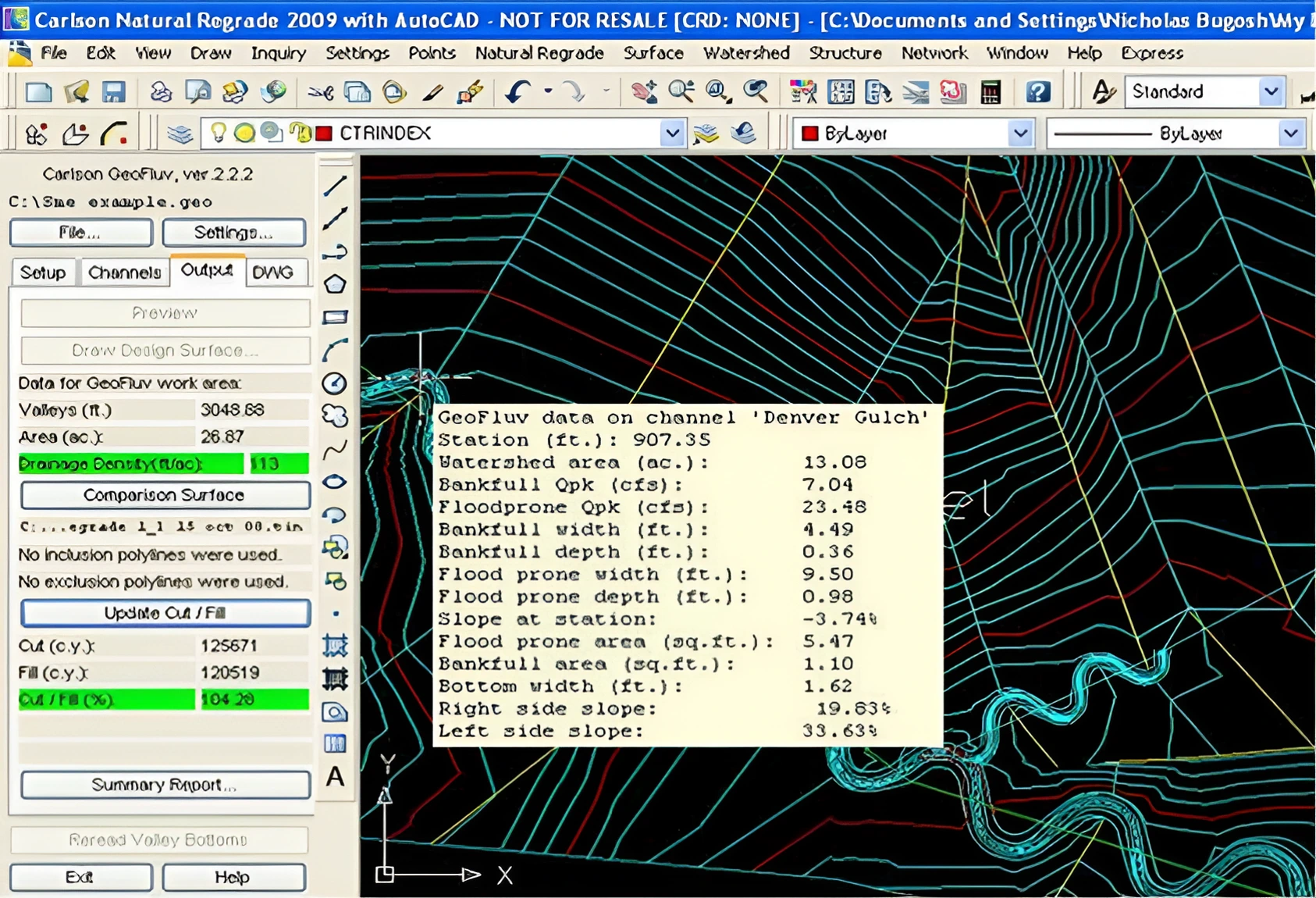
Here is a Natural Regrade software screen showing immediate feedback on drainage density and cut / fill balance as well as the ability to read and display design characteristics directly from the drawing wherever the cursor is placed on a 3D design line.

Get more information by visiting the Carlson Software Natural Regrade website at Carlson Software for the Natural Regrade computer module with GeoFluv.

Please contact GeoFluv directly to discuss your software needs and to obtain a quotation.